Tarahuín Lake
| Tarahuín Lake | |
|---|---|
| Coordinates | 42°42′52.30″S 73°44′11.76″W / 42.7145278°S 73.7366000°W |
| Catchment area | 38.1 km2 (14.7 sq mi) |
| Basin countries | Chile |
| Max. length | 6.4 km (4.0 mi) |
| Max. width | 1.5 km (0.93 mi) |
| Min. width | 0.5 km (0.31 mi) |
| Surface area | 7.7 km2 (3.0 sq mi) |
| Average depth | 22.2 m (73 ft) |
| Max. depth | 33 m (108 ft) |
| Water volume | 0.170 km3 (0.041 cu mi) |
| Shore length1 | 20.0 km (12.4 mi) |
| Surface elevation | 66 m (217 ft) |
| References | [1] |
| 1 Shore length is not a well-defined measure. | |
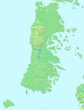
Tarahuín Lake (Spanish: Lago Tarahuín) is a lake in south-central Chiloé Island, Chile. It has an area of 7.7 km2.[1] The lake's catchment basin is mostly made up of hilly terrain that is covered by native forest, and to a lesser extent natural prairies.[1]
Chile Route 5 passes bext to the lake's western end.
References[edit]
- ^ a b c Villalobos, L., Parra, O., Grandjean, M., Jaque, E., Woelfl, S., Campos, H. (2003). A study of the river basins and limnology of five humic lakes on Chiloé Island. Revista Chilena de Historia Natural, 76 (4), 563–590.


