
Valthermond
Valthermond | |
|---|---|
 | |
 Valthermond Location of the village in the province of Drenthe  Valthermond Valthermond (Netherlands) | |
| Coordinates: 52°52′31″N 6°56′56″E / 52.87528°N 6.94889°E | |
| Country | Netherlands |
| Province | Drenthe |
| Municipality | Borger-Odoorn |
| Established | 1853 |
| Area | |
| • Total | 33.40 km2 (12.90 sq mi) |
| Elevation | 10 m (30 ft) |
| Population (2021)[1] | |
| • Total | 3,375 |
| • Density | 100/km2 (260/sq mi) |
| Time zone | UTC+1 (CET) |
| • Summer (DST) | UTC+2 (CEST) |
| Postal code | 7876[1] |
| Dialing code | 0591 |
Valthermond is a village in the Dutch province of Drenthe. It is a part of the municipality of Borger-Odoorn, and lies about 18 km north of Emmen.
History[edit]
The village was first mentioned between 1851 and 1855 as Valther Mond, and means "(canal) which has its mouth (in a main canal) belonging to Valthe". It is named after the eponymous canal which was dug in 1833 to excavate the peat in the area. A second canal was later dug, and that village and canal were named 2e Valthermond.[3] The village was founded in 1853, and is one of the longest excavation settlements of the Netherlands.[4]
The Dutch Reformed church was built in 1883, and a tower was added in 1925. A Baptist church was built in 1914, and is one of the few Baptist churches in the Netherlands other than the Mennonite churches.[4] Valthermond used to have a railway station on the Stadskanaal to Ter Apel border railway line between 1924 and 1935. It is in use by a museum railway line.[5] The former steam forge dates from the 1920s and used to make railway carriage and bridge parts for the peat excavation. It became a provincial monument in 2015.[6]
Gallery[edit]
-
 Street view
 -
 Railway line
 -
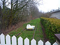
 Farm in Valthermond
 -
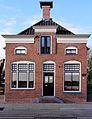 Office and residential home of the peat excavation company


References[edit]
- ^ a b c "Kerncijfers wijken en buurten 2021". Central Bureau of Statistics. Retrieved 11 April 2022.
- ^ "Postcodetool for 7876AA". Actueel Hoogtebestand Nederland (in Dutch). Het Waterschapshuis. Retrieved 11 April 2022.
- ^ "Valthermond (geografische naam)". Etymologiebank (in Dutch). Retrieved 11 April 2022.
- ^ a b Ronald Stenvert (2001). Valthermond (in Dutch). Zwolle: Waanders. p. 61. ISBN 90 400 9454 3. Retrieved 11 April 2022.
- ^ "station Musselkanaal- Valthermond". Stationsweb (in Dutch). Retrieved 11 April 2022.
- ^ "Valthermond". Plaatsengids (in Dutch). Retrieved 11 April 2022.
External links[edit]
![]() Media related to Valthermond at Wikimedia Commons
Media related to Valthermond at Wikimedia Commons
| International | |
|---|---|
| National | |
| Geographic | |