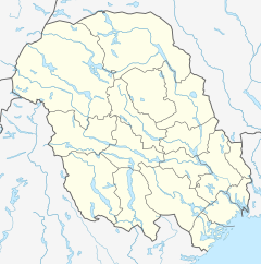
Vinjeåi
| Vinjeåi | |
|---|---|
| Location | |
| Country | Norway |
| County | Telemark |
| Municipalities | Vinje Municipality |
| Physical characteristics | |
| Source | Vinjevatn |
| • location | Tveitogrend, Vinje |
| • coordinates | 59°34′12″N 7°57′24″E / 59.5700369°N 7.9565443°E |
| • elevation | 466 metres (1,529 ft) |
| Mouth | Tokke river |
• location | Åmot, Vinje |
• coordinates | 59°33′56″N 7°59′54″E / 59.565643°N 7.9984491°E |
• elevation | 426 metres (1,398 ft) |
| Length | 2.6 km (1.6 mi) |
| Basin size | 919 km2 (355 sq mi) |
| Discharge | |
| • average | 40 m3/s (1,400 cu ft/s) |
Vinjeåi is a river in Telemark county, Norway. The 2.6-kilometre (1.6 mi) long river starts at the southeastern end of the lake Vinjevatn where the water flows out into the river. The river flows downstream and end when it joins the river Tokke at the village of Åmot. Vinjeåi was regulated as part of the Tokke hydroelectric power development in the 1960s, and water from Vinjevatn is transferred through tunnel to the Tokke Hydroelectric Power Station.[1][2]
See also[edit]
References[edit]
- ^ Lundbo, Sten, ed. (22 December 2020). "Vinjeåi". Store norske leksikon (in Norwegian). Kunnskapsforlaget. Retrieved 7 January 2023.
- ^ "Elvenett" (in Norwegian). Norwegian Water Resources and Energy Directorate. Retrieved 7 January 2023.


