
Zapatilla (mountain)
| Zapatilla | |
|---|---|
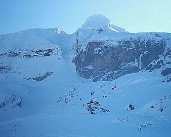
 Zapatilla, Candanchú, 15 March 2014 | |
| Highest point | |
| Elevation | 2,242 m (7,356 ft) |
| Prominence | 14.028 m (46.02 ft) |
| Coordinates | 42°46′32.30″N 0°33′08.51″W / 42.7756389°N 0.5523639°W |
| Geography | |
 Zapatilla | |
| Country | Spain |
| Parent range | Pyrenees |
Zapatilla (also known as La Zapatilla) is a Spanish peak in the Pyrenees mountain range.
Location[edit]
It is located on the Spanish side of the French border, near the Candanchú ski resort. It is located at a height of 2,450 m (8,040 ft). The prominence is at 14.028 m (46.02 ft). Aspe is located adjacent to Zapatilla.[1]
The peak's La Zapatilla tube, an incline of 35º, is known for providing an extreme challenge to professional skiers and snowboarders.[2][3]
Gallery[edit]
-
 View of the Zapatilla tube, 20 December 2005
 -
 Zapatilla Tube (Candanchú), 24 February 2008

.jpg)
References[edit]
- ^ "La Zapatilla". PeakVisor. Retrieved 2022-04-29.
- ^ Urrutia, Javier. "Mendikat → Zapatilla, La (2225 m)". www.mendikat.net (in Spanish). Retrieved 2022-04-29.
- ^ "Esquí extremo en el icono de Candanchú". Red Bull (in Spanish). Retrieved 2022-04-29.
This article about a location in Aragon, Spain, is a stub. You can help Wikipedia by expanding it. |