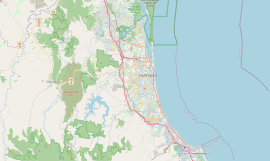
Boykambil, Queensland
Boykambil is a town in the City of Gold Coast, Queensland, Australia.[1] It is within the suburb of Hope Island.[2]
History[edit]
The name is an Bundjalung word. Its meaning is uncertain, referring either to a natural feature of Hope Island, from "buyu-gumma" meaning a broken leg, or "Boggumbil" meaning the Moreton Bay Chestnut (Castanospermum australe).[1]
Hope Island was named after colonial aristocrat Captain Louis Hope, who was granted approximately 1,800 acres (7.3 km2) of land at the mouth of the Coomera River in recognition of his contribution in developing the sugar industry in Queensland.[3] In May 1874, Hope subdivided his land on Boykambil Island into smaller farm lots of 30 to 50 acres (12 to 20 ha).[4] However, at July 1876 most of the land (1,744 acres (706 ha) remained unsold.[5]
It was declared a town on 1 March 1968 by the Queensland Place Names Board.[1]
References[edit]
- ^ a b c "Boykambil – town in City of Gold Coast (entry 4218)". Queensland Place Names. Queensland Government. Retrieved 29 November 2019.
- ^ "Queensland Globe". State of Queensland. Retrieved 12 January 2020.
- ^ "Hope Island history". Gold Coast City Council. Archived from the original on 13 September 2012. Retrieved 12 January 2020.
- ^ "Classified Advertising". The Brisbane Courier. Queensland, Australia. 4 May 1874. p. 4. Retrieved 12 January 2020 – via Trove.
- ^ "Classified Advertising". The Brisbane Courier. Queensland, Australia. 18 July 1876. p. 4. Retrieved 12 January 2020 – via Trove.


