Carstairs Junction
Carstairs Junction
| |
|---|---|
 Station Road, Carstairs Junction | |
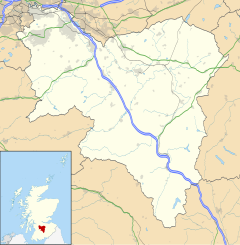
Location within South Lanarkshire | |
| Population | 670 (mid-2020 est.)[1] |
| OS grid reference | NS951454 |
| • Edinburgh | 29 miles (47 km) |
| • London | 393 miles (632 km) |
| Community council |
|
| Council area | |
| Lieutenancy area | |
| Country | Scotland |
| Sovereign state | United Kingdom |
| Post town | LANARK |
| Postcode district | ML11 |
| Dialling code | 01555 |
| Police | Scotland |
| Fire | Scottish |
| Ambulance | Scottish |
| UK Parliament | |
| Scottish Parliament | |
Carstairs Junction (Scottish Gaelic: Snaim Caisteal Tarrais) is a village in South Lanarkshire. Taking its name from the village of Carstairs and nearby railway junction, the village grew around the railway station which opened in 1848. In 2011 it had a population of 747.[2]
The village has a primary school, Carstairs Junction Primary School.[3] A church, Pettinain Church, is Category B listed.[4]
References[edit]
- ^ "Mid-2020 Population Estimates for Settlements and Localities in Scotland". National Records of Scotland. 31 March 2022. Retrieved 31 March 2022.
- ^ "Area Profiles". Scotland's Census 2011. National Records of Scotland. Retrieved 3 September 2019.
- ^ White, Chloe (27 March 2022). "Carstairs' school has STEM 'garden' classroom officially opened". Rail Advent. Retrieved 28 March 2022.
- ^ "Pettinain Church, Pettinain, South Lanarkshire". British Listed Buildings. Retrieved 28 March 2022.
External links[edit]


