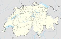
Eigerwand railway station
Eigerwand | |||||||||||
|---|---|---|---|---|---|---|---|---|---|---|---|
 | |||||||||||
| General information | |||||||||||
| Location | Eigerwand Grindelwald, Bern Switzerland | ||||||||||
| Coordinates | 46°34′52″N 08°00′13″E / 46.58111°N 8.00361°E | ||||||||||
| Elevation | 2,864 m (9,396 ft)[1] | ||||||||||
| Line(s) | Jungfraubahn | ||||||||||
| History | |||||||||||
| Opened | 28 June 1903 | ||||||||||
| Closed | 2016 | ||||||||||
| Services | |||||||||||
| |||||||||||
| Location | |||||||||||

Eigerwand is a currently disused underground railway station on the Jungfrau railway, which runs to the Jungfraujoch from Kleine Scheidegg. The station is situated just behind the north wall of the Eiger, and its principal purpose was to allow passengers to observe the view through a series of windows carved into the rock face. Trains to Jungfraujoch used to stop at the station for five minutes.[1][2][3][4]
However, since late 2016, after the introduction of new, faster, rolling stock, the Jungfraubahn no longer stops here.[5] Indeed, much of the 2017 publicity material fails to acknowledge that this viewpoint station ever existed.
The station opened on 28 June 1903, with the extension of the Jungfraubahn from its previous temporary terminus at Rotstock station.[6] After further construction, the line was extended to Eismeer station on 25 July 1905, and Eigerwand became an intermediate stop.[2][7]
Administratively, the station is in the municipality of Grindelwald in the canton of Bern. However, the only access to the station other than by train is a door in the sheer face of the mountain. This has, on occasion, been used to rescue mountaineers stranded on the mountain, most famously during the 1936 Eiger north face climbing disaster.[2][3] It features in this capacity in the film The Eiger Sanction.
It also lies right next to the Stollenloch, an exit and unofficial stop which is typically used by mountaineers to bypass the lower approach of the North Face.[8][9]
Prior to its closure, the following passenger trains operated:[4][10][11]
| Operator | Train Type | Route | Typical Frequency | Notes |
|---|---|---|---|---|
| Jungfraubahn | Kleine Scheidegg - Eigergletscher - Eigerwand - Eismeer - Jungfraujoch | 2 per hour | Uphill trains only |
See also[edit]
References[edit]
- ^ a b Eisenbahnatlas Schweiz. Verlag Schweers + Wall GmbH. 2012. p. 82. ISBN 978-3-89494-130-7.
- ^ a b c Allen, Cecil J. (1958). Switzerland's Amazing Railways. London: Thomas Nelson and Sons. p. 141.
- ^ a b map.geo.admin.ch (Map). Swiss Confederation. Retrieved 2013-02-04.
- ^ a b "The Jungfrau Railway – A Pioneering Work". Jingfraubahn. Archived from the original on 2013-02-02. Retrieved 2013-02-07.
- ^ Buchs, Christoph (2016-10-27). "Kein Stopp mehr bei den Eigerwand-Fenstern". Berner Zeitung, Berner Zeitung (in German). ISSN 1424-1021. Retrieved 2017-07-19.
- ^ "Jungfrau Railway: Rocky road to the project of the century". Jungfrau.ch. Retrieved 2 June 2018.
- ^ "The Jungfrau Railway – History". Jingfraubahn. Archived from the original on 2013-04-07. Retrieved 2013-02-08.
- ^ "The Eiger the Hard Way: Britain's Boldest Take on the North Face". Rock and Ice. 8 January 2014. Archived from the original on 18 January 2022. Retrieved 2 June 2018.
- ^ Daniel Anker and Rainer Rettner. "Chronology of the Eiger from 1252 to 2013". Retrieved 2 June 2018.
- ^ "Interlaken–Lauterbrunnen–Wengen–Kleine Scheidegg–Jungfraujoch" (PDF). Bundesamt für Verkehr. Retrieved 2013-01-28.
- ^ "Interlaken–Grindelwald–Kleine Scheidegg–Jungfraujoch" (PDF). Bundesamt für Verkehr. Retrieved 2013-01-28.
External links[edit]
 Media related to Eigerwand railway station at Wikimedia Commons

