
Hilgard, Oregon

Hilgard is an unincorporated community in Union County, Oregon, United States, at the junction of Oregon Route 244 with Interstate 84/U.S. Route 30, near the Grande Ronde River.[1] It is also the site of a junction (wye) of the Union Pacific Railroad. Hilgard Junction State Recreation Area is across the river from the community.
The Oregon Trail passed through this location, where the covered wagons had to maneuver downhill from La Grande.[2] Most emigrants camped at Hilgard before continuing back uphill towards Emigrant Springs or Meacham.[3]
Hilgard was named for both Eugene W. Hilgard, dean of the College of Agriculture at the University of California, and for Henry Villard, whose name prior to immigrating to the United States was Ferdinand Heinrich Gustav Hilgard.[4][5] Villard was Hilgard's cousin, and when he built the Oregon Railroad and Navigation Company railroad line over the Blue Mountains,[5] he enlisted Hilgard to make an agricultural survey of the area.[4] In July 1883, a post office named "Dan" was established.[4] The name was changed to "Hilgard" in August of that year when the well-known Eugene Hilgard was in the Pacific Northwest.[4] The office closed in 1943.[4]
In the early 20th century, the Hilgard vicinity had several sawmills.[3] The Mount Emily Lumber Company had a mill there in the 1920s.[6]
References[edit]
- ^ "Hilgard". Geographic Names Information System. United States Geological Survey, United States Department of the Interior. November 28, 1980. Retrieved January 13, 2010.
- ^ "Northeast Oregon: Primitive Camping" (PDF). Oregon Parks and Recreation Department. April 2009. Retrieved January 13, 2010.
- ^ a b Beckham, Stephen Dow. "Grande Ronde River Oregon: River Widths, Vegetation Environment, and Conditions Shaping Its Condition, Imbler Vicinity to Headwaters" (PDF). Interior Columbia Basin Ecosystem Management Project. pp. 9, 26. Archived from the original (PDF) on May 15, 2009. Retrieved January 13, 2010.
- ^ a b c d e McArthur, Lewis A.; McArthur, Lewis L. (2003) [1928]. Oregon Geographic Names (7th ed.). Portland, Oregon: Oregon Historical Society Press. p. 467. ISBN 978-0875952772.
- ^ a b Deumling, Dietrich (1972). The Roles of the Railroad in the Development of the Grande Ronde Valley (masters thesis). Flagstaff, Arizona: Northern Arizona University. p. 31,81. OCLC 4383986.
- ^ "City of Prineville Railroad". Active Short Lines of the Pacific Northwest. Retrieved January 13, 2010.
External links[edit]
- Oral history of Union County, Oregon (PDF) from the Oregon Historical Society
45°21′07″N 118°13′41″W / 45.352074°N 118.228002°W
Municipalities and communities of Union County, Oregon, United States | ||
|---|---|---|
| Cities | 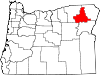 | |
| Unincorporated communities | ||
| Indian reservation | ||
| Ghost town | ||
This Union County, Oregon state location article is a stub. You can help Wikipedia by expanding it. |