
Miminegash Range Lights
 | |
| Location | Miminegash Prince Edward Island Canada |
|---|---|
| Coordinates | 46°52′49″N 64°14′06″W / 46.880203°N 64.235049°W |
| Tower | |
| Constructed | 1886 (first) |
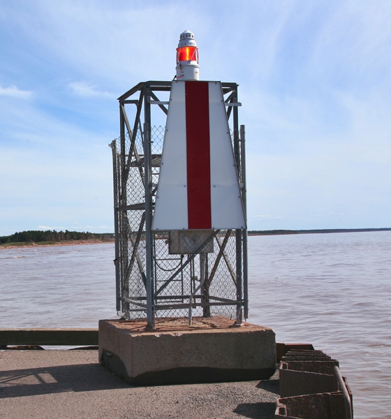
| Construction | steel skeletal mast |
| Height | 4 metres (13 ft) |
| Shape | square prism skeletal mast with beacon |
| Markings | white trapezoidal daymark with a red vertical stripe |
| Operator | Canadian Coast Guard[2] |
| Light | |
| Deactivated | 1972 (first) |
| Focal height | 6 metres (20 ft) |
| Range | 8 nautical miles (15 km; 9.2 mi)[1] |
| Characteristic | F R |
The Miminegash Range Lights were a set of range lights on Prince Edward Island, Canada. They were built in 1886, and deactivated in 1972; only the rear tower has survived.[3]
See also[edit]
References[edit]
- ^ List of Lights, Pub. 110: Greenland, The East Coasts of North and South America (Excluding Continental U.S.A. Except the East Coast of Florida) and the West Indies (PDF). List of Lights. United States National Geospatial-Intelligence Agency. p. 2017.
- ^ Rowlett, Russ. "Lighthouses of Canada: Western Prince Edward Island". The Lighthouse Directory. University of North Carolina at Chapel Hill. Retrieved January 9, 2016.
- ^ Rowlett, Russ. "Lighthouses of Canada: Eastern Prince Edward Island". The Lighthouse Directory. University of North Carolina at Chapel Hill. Retrieved August 2, 2009.
External links[edit]
- Picture of Miminegash Front Range Light Lighthouse Friends
- Aids to Navigation Canadian Coast Guard
This Prince Edward Island lighthouse-related article is a stub. You can help Wikipedia by expanding it. |